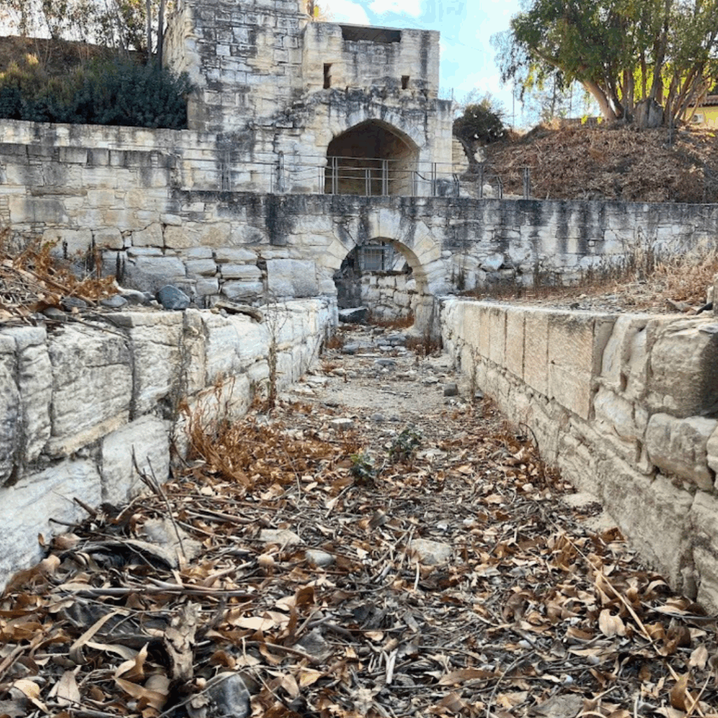
Water Heritage in European Rural Mediterranean. Re(dis)covering water heritage systems to face climate challenges learning from our past
Short description
WatHer revives centuries-old water heritage systems (WHS) as a modern solution to drought in rural Mediterranean areas. The project restores traditional canals, ponds, and irrigation ditches—long neglected but proven to capture and store water sustainably.
In selected pilot sites, WHS are mapped, restored, and monitored using a mix of field knowledge and modern tools such as Geographic information system (GIS) and environmental sensors. Action plans are co-designed with local communities, blending ancestral techniques with today’s ecological standards.
To ensure uptake, the project delivers training guidelines, engages local actors through seminars and consultations, and builds a joint strategy for WHS reuse. Through transnational cooperation -within the Global Network of Water Museums- these methods will be carried across borders, turning field-tested heritage into a shared Mediterranean resource.
Project partners:
Politecnico di Milano (IT, Lead partner)
University of Padova (IT)
University of Granada (ES)
University of Algarve (PT)
IN LOCO Association (PT)
OTRA – Island Development Agency Ltd (HR)
BSC – Business support centre Ltd., Kranj (SI)
Cyprus University of Technology (CY)
Laona Foundation for the Conservation and Regeneration of the Cypriot Countryside (CY)
Documenting values, functions and management of Water Heritage Systems
WP1 will build baseline knowledge on WHS in rural Mediterranean areas, focusing on their occurrence, typologies, historical and current value, and challenges, particularly regarding modern irrigation systems and climate change impacts. Partners will document historical and current WHS management practices through literature review and interviews with local farmers and municipalities, integrating the data into a joint GIS platform to identify territorial best practices and support the development of joint strategic restoration guidelines.
A WebGIS platform will be developed to centralize and analyze WHS datasets, digitizing analogue data and integrating historical maps, geo-tagged photos, hydrological data, and satellite imagery. Real-time, geo-referenced data collection will allow Project Partners’ researchers and communities to document WHS conditions efficiently. The platform will support, hydrological modeling, ecosystem service assessments, and change detection analysis, providing a dynamic tool for monitoring restoration efforts. It will remain active and continuously updated, ensuring a comprehensive, publicly accessible resource on WHS.
An evaluation model will be developed to assess the efficiency of restored WHS, providing a common and simplified method for collecting and analyzing data on WHS restoration effects. It will evaluate water quantity and quality, responses to weather, and different water utilization practices. Relevant parameters such as soil moisture, evapotranspiration, groundwater recharge, and water levels will be considered depending on WHS type. A structured data collection approach will ensure standardized and consistent methodology.
Work Package 2
Testing WHS restoration and evaluation models for the measurement of WHS efficiency
WP2 transitions from a broad overview to an in-depth analysis of specific WHS in each pilot area. Local action plans will be developed detailing restoration feasibility, community engagement, and investment plans. All parameters needed for future WHS restoration will be studied, including location, ownership, condition, impact, and restoration feasibility, prioritising sites for test restoration. Findings will be documented and shared via the GIS platform. Pilot action plans will align with the Joint Strategy, outlining participatory approaches, stakeholder involvement, and investment requirements.
WP2 focuses on restoring at least nine WHS in pilot areas, including water ditches, meadows, ponds, canals, and tanks. Restoration will follow previous action plans and include planting vegetation for carbon sequestration. Activities will combine external expertise and participatory workshops, engaging local communities to raise awareness and ensure sustainable governance of restored WHS. All pilot restoration reports will be documented.
Hydrological and ecological benefits will be evaluated before, during, and after WHS restoration, following the protocol elaborated in WP1. This will assess whether the evaluation model is operative and accessible to both scientists and local communities, and whether restoration has improved water supply and quality, ecosystem services, and community engagement. Guidelines will be provided for data collection and water quality analysis, and results will be documented in a report contributing to the evaluation of WHS restoration cost-benefits.
Work Package 3
Promotion of WHS reuse and integration in policies as a sustainable solution
A one-day seminar will be organized in the territories, targeting audiences from local to national level. It will disseminate project results and promote policy uptake, presenting the joint Strategy/Action Plan, overall project outcomes, and local WHS restoration processes and results, including a video from the Test phase. The event will include visits to restored sites and submission of the Strategy/Action Plan for endorsement by farmers’ organizations, authorities, and water management stakeholders, who will be invited to support the proposed measures.
Online consultancy will be provided to local and national stakeholders to facilitate knowledge transfer, encourage WHS restoration replication, and support similar rural territories. A common framework will guide the consultancy, including presentations on WHS restoration and steps for community and stakeholder involvement. Participants will receive support on assessing WHS benefits, legal and technical advice, and financial requirements, enhancing their capacity to implement restoration projects. Results will be documented and shared to increase knowledge on restoring and valuing WHS in rural Mediterranean territories.
Knowledge will be shared with an international audience working on water issues, promoting endorsement of the Strategy/Action Plan on a broader scale. The project’s closing event will be integrated into a high-visibility international conference, highlighting results and WHS restoration efforts. Stakeholders including policymakers, water management experts, associations, farmers, and the scientific community will be engaged. Project results will also be disseminated through Mediterranean networks, and the Action Plan will be presented to the Union for the Mediterranean to encourage international endorsement.