
LIFE – AgrOassis: Regenerative approaches for building climate change resilience in EU agricultural regions prone to desertification
Soil Improvement by Mulching and Minimum or No-tillage Practices
LIFE-AgrOassis project aims to address the challenges faced by agricultural soils in Cyprus. Agricultural soils in Cyprus have low water infiltration rates, poor structure, and vulnerability to erosion and desertification worsened by climate change. Traditional tillage practices, in cereals in Cyprus, exacerbate these issues by accelerating erosion and degrading soil quality. By promoting no-tillage and minimum tillage methods, we aim to mitigate soil compaction, enhance soil health, and preserve biodiversity, and also improve soil resilience against diseases. These practices not only increase the soil organic matter and improve water retention but also reduce soil erosion and associated economic costs for farmers. They result in significant cost savings on fuel, labor, and equipment maintenance, thereby reducing carbon emissions. Additionally, maintaining crop residue on fields after harvesting helps protect soil from erosion and temperature extremes, crucial steps in combating desertification and preserving soil health in Cyprus. Finally, no-tillage practices support predatory arthropods, contributing to natural pest control.
Cereal farmers usually attempt to maximize straw production for use as animal feed by strip mowing during harvesting, often leaving minimal plant residue for soil protection. Consequently, exposed fields post-harvest contribute to erosion and desertification, soil degradation and moisture loss, necessitating urgent reversal. Alternatively, maintaining plant residue cover during summer can significantly mitigate temperature extremes and enhance soil moisture, crucial for combating desertification.
This action aims at changing farmer attitude towards land management in Cyprus and Greece by introducing minimum tillage farming in Cyprus, with a small disruption of the soil only before seeding, and by enhancing no-tillage farming in Greece. It is anticipated that farmers will also benefit from the advantages of soil mulching by the mechanically destroyed weed biomass that goes in parallel with the adoption of minimum or no-tillage systems.
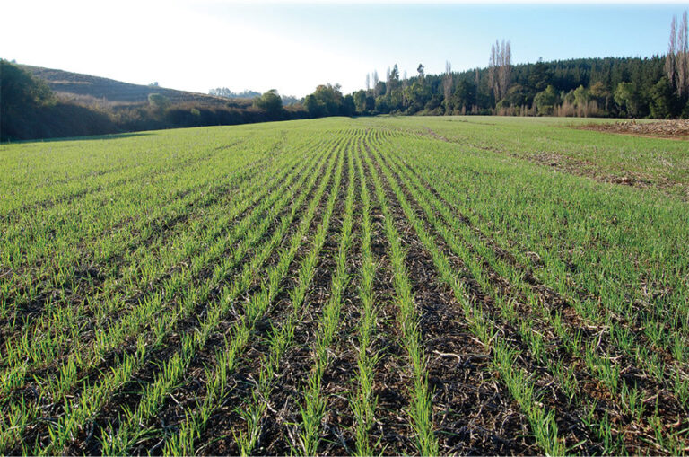
Implementation of no-tilling, minimum tillage and mulching practices
In arable fields and olive groves in Cyprus and Thessaly:
The aboveground biomass of wild vegetation will be destroyed using grass mower (stem cutter) or other suitable machinery but not ploughing. Cut biomass will be used to create ground cover.
In cereal fields in Cyprus, just before sowing, the soil will (can) be cultivated superficially with a disc harrow to destroy the roots of weeds. In Thessaly no-till farming has been successfully tested in the framework of a previous European project, so in the LIFE-AgrOassis project fields will be sown directly using a no-till seeder.
In the first year of implementation, Cypriot farmers have already begun applying minimum tillage practices to 30 hectares of cereal fields. Similarly, in Thessaly, 10 hectares in Karditsa have been integrated into the project’s no-till farming initiative.
In the olive groves in Crete:
Producers have to treat weeds by cutting with mowers and leave cut biomass on the soil surface.
The implementation of this action in Crete will start in 2024.
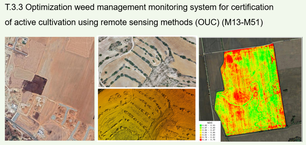
Optimization of the weed management monitoring system for certification of active cultivation using remote sensing methods
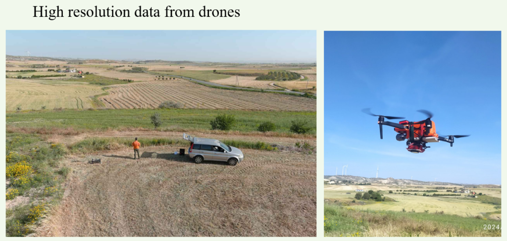
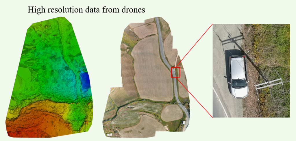
Aiming toward optimizing the weed management monitoring system a group of remote sensing approaches will be tested and evaluated to design a methodology easily replicated and implemented by the public authorities. Those approaches include analysing remote sensing data from various very high resolution instruments such as satellites (e.g. Copernicus Sentinel 2 & 3, ikonos) and Drones (high resolution spatial data). Those instruments meet different specifications and although valuable for research their use is often complex, time consuming and difficult for authorities that need fast and accurate methods to assist and contribute to the decision making process.
As part of this Task, seasonal and monthly remote sensing data will be acquired by the above instruments and photo interpretation though object-based classification and spatial analysis will be conducted via a number of instruments (eCognition, ArcGIS, Pix4D). Several vegetation indexes (e.g. NDVI, EVI) and high resolution spatial images will be evaluated towards better identification and classification of various land plot parameters (e.g. soil erosion, soil vegetation cover, solid moisture holding capacity) related towards weed management. The results of these attempts will also be field validated. The use of supplementary data from farmers participation instruments such as DIONE farmers’ geotagged photos framework (https://dione-project.eu), currently tested by the Cyprus AgriculturalPayments Organisation (CAPO), will also be taken into account during calibration and field validation stage.
As a result, a step-by-step methodological approach will be developed providing detailed information on the national authorities towards optimizing weed management monitoring. This methodology will allow rapid assessment of practices within agricultural land plots contributing towards the control of land degradation and desertification. The developed methodology will also be thoroughly discussed with the European Soil Data Centre (ESDAC) as to be included within EC monitoring tools such as the Desertification Indicator System for Mediterranean Europe (DIS4ME).
Photos below: @lifeagroassis